This is an old revision of the document!
Table of Contents
Areas Excluded from Dredging
MLA/2025/00263
The River Tees has a heavy industrial history of over 150 years and because of this has one of the most contaminated riverbed sediments of any port in the UK.
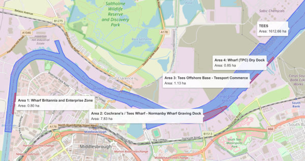
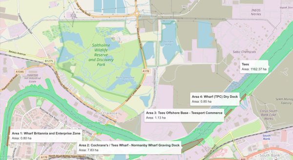
While the names of excluded areas where the river was considered too toxic to dredge where specified in both MLA/2025/00263 and the previous 10 year licence application MLA/2015/00088, the exact coordinates were not specified. These were added after MLA/2025/00263 was granted when a judicial review highlighted this error in granting the licence.
| Dredge Parameter | Value |
|---|---|
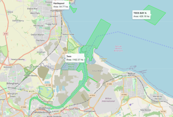
| Total dredged area of the River Tees | 1162.37Ha |
| Total excluded area from dredging | 10.61Ha |
| % of total dredged area excluded | 0.91% |
| Area of smallest excluded area | 0.8Ha |
| % of total dredged area made up by smallest excluded area | 0.07% |
| Number of times smallest excluded area fits into total dredge area | 1453 |
PD Ports marine licence application MLA/2025/00263 supplied only 31 samples as specified by the sampling plan supplied by the MMO on the recommendation of Cefas.
The licence was granted with just 31 samples taken over the whole 1162.37Ha area, meaning that there was only 1 sample for every 37.50Ha or 1 sample for every 54 football pitches.
| # | Name | Area Ha | % Total Dredge Area | # Fit Into Total Dredge Area | # Fit Into Single Sample Area |
|---|---|---|---|---|---|
| 1 | Britannia Wharf and Enterprise Zone | 0.80 | 0.07 | 1452.96 | 46.87 |
| 2 | Cochranes Tees Wharf - Normanby Wharf Graving Dock | 7.83 | 0.67 | 148.45 | 4.79 |
| 3 | Tees Offshore Base - Tees Commerce | 1.13 | 0.10 | 1028.65 | 33.18 |
| 4 | Wharf(TPC) Dry Dock | 0.85 | 0.07 | 1367.49 | 44.11 |
| All | Total Area | 10.61 | 0.91 | 109.55 | 3.53 |
The table above just drives home that 31 samples would have been drastically insufficient to be able to detect the current excluded areas and as such will not be able to detect similar currently unknown highly toxic areas within the total dredge area.
The number of times an area fits into the total dredge area is dramatic, for the smallest excluded area of 0.8Ha it fits 1452 times. While this sounds like a lot of samples in fact to be sure of finding such small areas then the best approach would be adopt a grid and divide the dredge area into 50m squares and taking a sample in the middle each square. This would give a greater than 95% chance of detecting all the 0.8Ha, but would require over 4,600 samples.
4,600 samples is the maximum number and in fact by using knowledge of the river the number of samples necessary can be reduced considerably but not to 31.
The Cefas justification for 31 samples rather than working from a high number instead takes historical precedent, economic costs as the justification and the OSPAR volume table. Where the OSPAR volume table rather sets a minimum number of samples which should be taken for anything other than a deep capital dredge when read in context and so this number is inappropriate for a large area maintenance dredge.
The OSPAR guidance states that both spatial and volumetric representation must be achieved. To this end, the OSPAR guidance provides two tables, the volumetric table which use the amount to be dredged to suggest the number 31, whereas the are table suggests
MLA/2015/00088
| Dredge Parameter | Value |
|---|---|
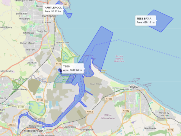
| Total dredged area of the River Tees | 1612.66Ha |
| Total excluded area from dredging | 10.61Ha |
| % of total dredged area excluded | |
| Area of smallest excluded area | 0.8Ha |
| % of total dredged area made up by smallest excluded area | |
| Number of times smallest excluded area fits into total dredge area | |